Search
(+)
cartoon
dealer
buy stock illustrations
Home
My rookie portfolio
📷 Upload yours 🤳
Find results that contain
all
of your keywords. Content filter is
on
. Search will return
best illustrations, stock vectors and clipart
.
Exclude
Make it so!
You have chosen to exclude "
" from your results.
Choose orientation:
Related commercial searches:
gyongyos
outline
map
fuzesabony
belapatfalva
vector
districts
hungary
colored
counties
neighbouring
countries
territories
detailed
regions
states
administrative
division
higt
subdivisions
cities
name
location
hajdú
bihar
region
fejér
Page
of 4
←
→
Order by:
relevancy of keywords
|
publishing date
|
most downloaded
Heves
Cartoons, Illustrations & Vector Stock Images
- 106 images
Gyongyos outline map
Fuzesabony outline map
Belapatfalva outline map
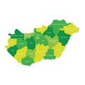
Vector map of districts of Hungary colored by counties with neighbouring countries and territories
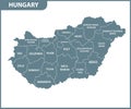
The detailed map of Hungary with regions or states. Administrative division
Hungary - map of counties
Hungary higt detailed map with subdivisions. Administrative map of Hungary with districts and cities name, colored by states and
Location Map of Hajdú Bihar Region
Location Map of Fejér Region
Highly detailed three dimensional map of Hungary with regions border
Location Map of Csongrád Region
Location Map of Municipality of Budapest
Location Map of Borsod Abaúj Zemplén Region
Location Map of Gyà âr Moson Sopron Region
Counties of Hungary. Map of regional country administrative divisions. Colorful vector illustration
Coat of arms of the city of Gyendyesh. Hungary
Coat of arms of the city of Belapatfalva. Hungary
Hungary - administrative map of counties
Counties of Hungary. Map of regional country administrative divisions. Colorful vector illustration
Vector illustration of administrative division map of Hungary. Vector map.
Vector illustration of administrative division map of Hungary.
Modern White Map of Hungary with Regions With Shadow
Hungary administrative divisions map. Flag of Hungary. Budapest cityscape. Vector illustration
Hungary map - cdr format
Next Page
←
↑
↓
→
See more images